
This is the first of two posts describing our visit to Glen Affric in north-west Scotland a couple of months ago, for a spot of Munro bagging. In this post, I describe ascents of the eight Munros in Glen Affric itself. In the following post, I describes ascents of the four Munros around Loch Mullardoch.
There are quite a few Scottish glens (or valleys) that get described as the most beautiful in Scotland. Obviously, they can’t all be, but Glen Affric, which is one of the ones that sometimes has the superlative attached to it, is certainly up there among the best.
To be honest, I didn’t know that much about it before I started planning our May holiday earlier this year, apart from the fact that it has a clutch of Munros that — as a part-time Munro bagger — I knew that I had to climb some day.
Situated due north and roughly parallel to the much better-known Glen Shiel — which I’ve travelled along umpteen times on the road to Skye — it bends north at its eastern end, merges into Strathglass and eventually spills into the Beauly Firth at Inverness.

There are 16 Munros accessible from Glen Affric: half in Glen Affric itself, and half in the two main side valleys that branch off it to the north, Glen Cannich and Strathfarrar. Edita and I booked a cottage in the sleepy village of Tomich, surrounded by forest, and picked off 15 of the 16 Munros in the two weeks we were there, only missing out on the last one when the weather worsened for our final two days.
In contrast to the majority of Scotland’s high mountain glens which have long been stripped of trees by deer, sheep and man, Glen Affric is richly forested. Much of it is owned by Forestry and Land Scotland, a government agency that is responsible for managing Scotland’s forests. While parts of the forest are managed commercially for timber (mostly pine), much of it is also mixed forest of birch, Scots pine, Douglas fir and mountain ash, managed for nature and tourism with a profusion of good forest trails.
Up Glen Affric’s sides, large swathes of open hillside have been fenced off from deer to enable native forest to regenerate. Two sizeable lakes, Loch Affric and Loch Beinn a’ Mheadhoin nestle on the valley floor. To the west, at the top end of the valley, the forest peters out and the valley becomes a more typical open glen of grassy hills dappled with granite and sandstone outcrops.
This trip report covers our ascents of the eight Munros in Glen Affric itself.
Day 1 — Sgurr nan Ceathramhnan (1,151m) and Mullach na Dheiragain (982m)

We began with the three least accessible: Sgurr nan Ceathramhnan (1,151m), Mullach na Dheiragain (982m) and An Socach (921m). All three can be hiked in a day from Alltbeithe Youth Hostel in the upper reaches of Glen Affric, but there’s a catch. Alltbeithe is 10km from the nearest road, close to the Cluanie Inn on the A87 through Glen Shiel. It’s even further, a full 14km, from the road end in Glen Affric itself, where we were staying. We therefore decided to climb them in two days with a wild camp.
Starting out from the River Affric car park at the eastern tip of Loch Affric, we walked along the Affric Kintail Way for the first three and half hours of the day, initially through pine forest on the south side of Loch Affric. The trail was broad and the terrain easy underfoot.
We left the forest towards the western end of the loch and earned our first mountain views. Two sizeable peaks, An Tudair (1,074m) and Sgurr na Lapaich (1,036m) rose above the north side of the loch. Despite their prodigious height, neither of these mountains are classed as Munros since the relative height gain between their parent peak Mam Sodhail (1,181m) is not considered high enough.

Beyond the western end of Loch Affric, we reached a junction of valleys as the forested Glen Ciche joined Glen Affric from the south. At Athnamulloch bothy, we crossed the River Affric and continued west. The change of scenery was stark. We had left the forests of Scots pine, birch and mountain ash behind, and entered a more typical Scottish highland valley; wide and open, with a greater sense of remoteness. We didn’t see a soul aside from a pair of mountain bikers who pedalled past in the opposite direction.
We arrived at Alltbeithe at 12 noon. There was no one around as we took the path north and finally began our ascent into the mountains. But first we stopped for lunch in a bed of soft moss at the base of the trail. The sun was burning brightly; I wiped the sweat from the corners of my eyes and applied another layer of sun cream. We would be making the bulk of the ascent during the heat of the day, but it wasn’t especially steep.
It took us two hours to climb through Coire na Cloiche and reach the ridge. The lower section passed through a fenced area full of young birch and mountain ash where an attempt is being made to regenerate the forest.

At the ridge we gazed down into the featureless bowl of Glen Choilich and could see the rest of the day’s walk stretching out before us. To the right of the glen, the twin domes of Carn Eighe (1,183m) and Mam Sodhail (1,181m) rose up like salt and pepper pots. Across the valley in front, the long ridge of Carn na Con Dhu fell away then rose again to the outlying Munro of Mullach na Dheiragain. We would end up there later that afternoon, but first we turned left and followed the ridge as it climbed steeply over Stob Coire na Clioche.
The triangle of Sgurr nan Ceathramhnan still seemed a long way off, so we stopped beneath it and enjoyed a second lunch. We hadn’t seen a soul since we left Glen Affric, so we were surprised to see dozens of tiny figures moving around on the summit. They remained there as we ate. When they finally started to descend towards us, they were moving so slowly, stopping frequently, that we wondered if they were mountain rescue volunteers evacuating an injured hiker.
We packed away our lunches and started climbing towards them. We were relieved to see that it was a large school party of 20-30 kids of varying ages, supervised by two older adults, a man and a woman. They were in high spirits and joked as they passed us.

We reached the summit of Sgurr nan Ceathramhnan at 3.30pm, seven hours after setting out. It was probably the latest I’ve ever reached my first Munro of the day, and we still had another one to come. At 1,151m, Sgurr nan Ceathramhnan was much higher than the surrounding landscape and provided a fine viewpoint. We could even see Skye Bridge and the Isle of Skye 32km away to the west.
We descended steeply 300m to the Bealach nan Daoine, where we left our packs behind a rock to make the long detour to Mullach na Dheiragain. It was 4.30pm and, having seen no one but the school party all afternoon, we didn’t expect to see anyone else up here so late. We were surprised to see two elderly gentlemen in red jackets coming towards us as we crossed Carn na Con Dhu. One of them made a joke about how far it was to the Munro. The long ridge of Carn na Con Dhu looked flat and easy as we gazed across at it from the far side of the valley, but it was jagged and awkward underfoot, with lots of up, down and boulder hopping.
Once past Carn na Con Dhu, it was a gentle grassy stroll up to the top of the innocuous summit of Mullach na Dheiragain. It had taken us an hour to make the detour, and would have been longer had we not left our packs. We staggered back, tired now after our day’s exertions.
We dropped down into Coire nan Dearcag at the top end of Glen Choilich, and found a wonderful camping spot on soft grass beside a bubbling stream. It was 7pm, but there were still a few hours of daylight left. Behind us lay Sgurr nan Ceathramhnan, and we could look out of the porch across the valley to the twin peaks of Carn Eighe and Mam Sodhail, the two highest peaks in Glen Affric and among the top 20 of all Munros

At 9pm as I was boiling a brew, I looked up to see a large furry shape pass by about 10m away. It was still light; we were on a boggy mountainside 750m up, and I assumed it must be a fox. But when I leaned to the left to get a better view, the snout was unmistakeable.
‘Whoa, it’s a badger!’ I cried.
A word of advice to young nature lovers. If you’re privileged enough to have a rare sighting of a badger at 750m on a remote mountainside, don’t yell ‘whoa, it’s a badger’ at the top of your voice. The correct procedure was to lean over and whisper, ‘psst, Edita, have a look at this’. Unfortunately, Trufflehunter was quickest to react. He glanced in my direction and scarpered. We didn’t see him again, but I did keep a torch close to hand in case we heard snuffling sounds outside our tent door later in the night.
As we settled in to sleep, we heard strange croaking noises that made it sound like we were surrounded by an army of frogs. Three days later I heard the same sound high in the sky above me and looked up to see, not a flying toad, but a ptarmigan.
Day 2 — An Socach (921m)

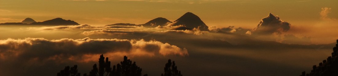
We packed up and left the corrie at 8.30 the following morning. We weaved across boggy ground, then angled up the hillside to rejoin the ridge at the same point where we’d arrived from the opposite side the previous afternoon. A cloud inversion provided a sea of white below us in Glen Choilich. From there it was a gentle 120m ascent to the top of our third Munro, An Socach (921m). We reached the top at 9.30, barely an hour after leaving camp, contrasting with the seven hours it had taken us to reach Sgurr nan Ceathramhnan the previous day.
We followed the ridge over another summit, before descending to Bealach Coire Ghaidheil, the col that separates the western Munros from the giant twins of Mam Sodhail and Carn Eighe. Instead of continuing up to Mam Sodhail, however, we descended a boggy trail back down to Glen Affric.
We returned to the car park at River Affric by the path on the north side of Loch Affric, thus completing a full circuit of the lake. The forest is not as dense on the north side, but this made for a more attractive walk. The trail climbed above the shore, providing pleasing views between ancient sprawling pines. At one point, a pair of stonechats, male and female, perched on adjacent fence posts and serenaded us as we passed.

Fifteen minutes short of the car park we passed above the turreted stately home of Affric Lodge and its sprawl of outbuildings, set among a copse of trees on a hilly promontory jutting into the lake. The whole compound was fenced off from the public. There was a cluster of security cameras at the main gate. We learned later that Affric Lodge is owned by the billionaire Matthews family, in-laws of Pippa Middleton, the crown princess’s younger sister. Affric Lodge is a luxury self-catering ‘cottage’ that those with more money than they know what to do with can hire for £12,000 a night. Controversially, the security fence now prevents access to a bridge, which previously facilitated a gentle two-hour walk around the eastern arm of Loch Affric.
We arrived back at River Affric at 2.30pm, in good time to spend a relaxing afternoon at our cottage in Tomich.
Day 3 — Mam Sodhail (1,181m), Carn Eighe (1,183m) and Beinn Fhionnlaidh (1,005m)

Buoyed by our 2-day backpacking adventure, we decided to tackle Glen Affric’s highest peaks, the twin pepperpots of Mam Sodhail (1,181m) and Carn Eighe (1,183m). We’d gazed at these two peaks from our campsite in Coire nan Dearcag as badgers hurtled past the night before. These are not just high peaks by Glen Affric standards: they are 14th and 12th respectively on the full list of 282 Munros. By taking in the outlying Munro of Beinn Fhionnlaidh (1,005m) and returning across 1,036m Sgurr na Lapaich (not a Munro, but should be), we were looking at a 10-hour day with nearly 2,000m of ascent.
Leaving from River Affric at 8.30, the first 75 minutes of the walk took us back along the pleasant forest trail above the north shore of Loch Affric that we’d returned along the previous day. We were pleasantly surprised to see the same stonechat (who I’m going to call Steve) minus his wife, serenading us on the same section of fence.
Beyond the forest, a mighty cleft came down between the mountains of An Tudair (1,074m and still not a Munro) and Sgurr na Lapaich. We took this north on a good rocky path into Coire Leachavie. The trail climbed high above the valley floor. We made good progress, passing a series of waterfalls crashing into rock pools on our left. After an hour of climbing, the trail flattened and we found ourselves in a green mountain sanctuary, walled in on three sides by An Tudair to our left and our first Munro, Mam Sodhail, to our right.

The trail passed across the sanctuary and climbed the wall at the far end in a series of zigzags. Towards the top, it slanted to the right and continued up a broad ridge to the summit of Mam Sodhail. We reached the summit at midday and took in the view. It was windy on top and we put on jackets, but the sun was bright and we could see for miles. To our left we looked across Glen Choilich to our wild camp and the Munros we climbed during our backpacking adventure. Less than a kilometre to the north was Mam Sodhail’s twin, Carn Eighe (1,183m), almost identical in height. Two kilometres beyond that, we could see the much lower outlying peak of Beinn Fhionnlaidh (1,005m).
The summit of Mam Sodhail was marked by a gigantic cairn, over 2m in height, but unless you climbed on top of it, the highest point was actually on a flat plateau about 30m away. We walked across to take selfies. The name Mam Sodhail sounds like a Caledonian profanity: the Scots Gaelic for a word that is commonly shortened to ‘Mofo’. This seemed appropriate. I realised that in order to descend by its east ridge and over Sgurr na Lapaich, as I intended, we would have to climb it twice.
But first we raced down its north flank, descending 150m in almost no time. On the way down we met a young couple coming up with big packs. They told us they had camped on the north side of Carn Eighe. They expressed surprise when I pointed out our own wild camp beneath Sgurr nan Ceathramhnan.

‘You’re travelling much lighter than we are,’ the man said.
I laughed, for we were carrying only water, lunch and thin waterproofs. ‘Yesterday, we were carrying the same as you,’ I said. ‘Today is just a day hike.’
Remarkably, they were the first hikers we had seen all day. We saw only one further person as we sat and had our lunch on top of Beinn Fhionnlaidh later in the afternoon. It could not have been better weather for hiking, and it was hard to understand why these peaks were so quiet.
It took us less than an hour to reach the top of Carn Eighe from Mam Sodhail. We sat on the sheltered northern side and had our first lunch of the day beside the summit cairn. Beinn Fhionnlaidh lay far beneath us at the end of the northern ridge of Carn Eighe. Like Mullach na Dheiragain two days earlier, it was a long detour to bag this outlying Munro, but its position at the end of the ridge was going to make it a fine viewpoint.
This time it was a 350m metre descent down to the low point of Bealach Beag on slopes that were alternately rocky and grassy. Our energy levels were high; we raced down and back up the other side. It was a steep but easy ascent up to Beinn Fhionnlaidh on a good path up grassy slopes. The top was a long, broad ridge with the summit at the far end.

We found a flat rock on the west side of the summit and stopped for our second lunch and a very satisfying trail beer in the heat of the afternoon sun. We looked north across Loch Mullardoch to a crumple of unidentified mountains as far as the eye could see. To the west, we looked across Glen Choilich to Mullach na Dheiragain, the sister outlier, and the glen west of Loch Mullardoch. These valleys were bleak and desolate. In contrast to forested Glen Affric, there was not a tree in sight. Although the valleys looked green and inviting, I knew they were likely to be lined with blankets of peat bog that would render them far from welcoming to cross.
We returned to Mofo by skirting across the western slopes of Carn Eighe. This route seemed easier than going back up to the summit and down again, but it was a bit of a slog, angling across boulder fields on steep, pathless terrain. We rejoined the main trail at the col beneath Carn Eighe, and reached Mofo’s summit for a second time at 3.30.
Sgurr na Lapaich looked far away and daunting, partly due to the streak of snow that still lay beneath its summit. In reality, it took barely an hour to get there. The ridge was easy and enjoyable, although the tinkle of rushing water in Coire Leachavie to our right was torture to Edita, who had run out of drinking water in the hot sun. Luckily I still had some to share.

The final ascent to the summit of Sgurr na Lapaich was a boring slog over stony ground, all the more annoying for the fact that it wasn’t even a Munro. We had one final snack beneath the summit, looking down at Loch Affric and the outbuildings of Affric Lodge (a.k.a. ‘Pippa’s gaff’).
There was a nice firm path down Sgurr na Lapaich’s south-east ridge; we hurtled down it, but at 600m the path disappeared into blanket bog, and our pace reduced to a slow trudge as we picked a route that avoided wet feet. Edita was able to refill her water bottle when we crossed a small stream.
Miraculously, the path reappeared on the other side of the stream, and we were able to follow it to reach another stony hill track that took us back down to the road beyond Pippa’s place. We were back at our car at 6.30 after 10 satisfying hours of hill walking.
Day 4 — Tom a’ Choinnich (1,112m) and Toll Creagach (1,054m)

We left the easy ones till last. We made a later start because we had to vacate our cottage that morning and move into the cottage next door. The car park at Chisholme Bridge was almost full by the time we parked up at 10am, but once again, we were to see virtually no one on the hills. Unless they were paddling out of sight in the loch, where everyone went remains a mystery.
After a brief diversion into the forest, following an ambiguous signpost at the back of the car park, we followed a forestry track for about two kilometres as it curled to the left up a broad valley. Parts of moorland beside the track were being reforested and had been fenced off from deer. At one point we passed bags of saplings left by the charity Trees for Life. To the right, above a bend in the river, we could see the rounded top of Toll Creagach, our second Munro. Higher up the valley, Tom a’ Choinnich, our first one, looked more mountainous. It had a jagged ridge at the southern end, leading to a gentler gradient towards the summit.
The track ended beneath Toll Creagach and we squelched along a boggy trail for another kilometre until a path branched off to the right up Tom a’ Choinnich’s south-east ridge. It was quite an interesting trail, weaving steeply up and over rocky outcrops on an obvious ridge. Edita raced on ahead without stopping. I had to yell for her to wait so that I could catch up and stop for a rest.

At about 950m the ridge ended and became more of an escarpment, with cliffs to the right and gentler slopes to the right. We slogged our way up this for another 200m, entering clouds just below the summit. We reached the top at about 1 o’clock and ate sandwiches against the summit cairn. The summit was a rocky plateau that partially obscured the view west. In theory, Tom a’ Choinnich is joined to Carn Eighe, one of the peaks we climbed the previous day, by a snaking 4km ridge. But the summit plateau hid many of the peaks, giving our position a sense of detachment. In any case, we were only afforded occasional glimpses through the drifting clouds.
We headed east, dropping 250m to Bealach Toll Easa. We did not have far to descend to get back beneath the mist. Toll Creagach was a much more rounded, gentler peak. The crossing from Tom a’ Choinnich passed over a grassy plateau before a long, gradual ascent to Toll Creagach’s distant dome. Halfway up an inquisitive ptarmigan dropped out of the sky croaking and came to say hello. It came within 10m of us and walked in bursts that made it impossible to photograph. Another interesting feature was an incongruous outcrop of white quartz that from a distance looked like bags of building materials.
We reached the broad summit at 2pm and a found flat rock shaped like a bench to have a second lunch and fend off an army of marauding horseflies. The bench looked straight across Loch Mullardoch to the four Munros we intended climbing the following week. It looked a monster journey from the eastern end of the loch across four mountains to the final one, An Socach, and then a long journey back again along the lake shore. The four mountains were widely separated. One of them, An Riabhachan, was a huge table-like plateau with no obvious summit.

There was no trail off the south side of Toll Creagach and we had 650m to descend to reach the forestry track we had followed up. But the slope was so gentle for the first 450m that the descent was easy and we were able to complete it without stopping. Only the last 200m above the track were steep, over rough slopes of heather, but thankfully it wasn’t too boggy and we kept dry feet.
After a short rest at the bottom, we raced back down the track, arriving back at the car park at 4.30. We had bagged all eight Glen Affric Munros in four energetic and highly satisfying days and were ready to celebrate.
You can see all my photos from our trip in my Glen Affric Flickr album.
Route maps
Day 1: Sgurr nan Ceathramhnan (1,151m) and Mullach na Dheiragain (982m)
Total distance: 30.63km. Total ascent/descent: 1,654m.
View route map and download GPX
Day 2: An Socach (921m)
Total distance: 20.83km. Total ascent/descent: 538m.
View route map and download GPX
Day 3: Mam Sodhail (1,181m), Carn Eighe (1,183m) and Beinn Fhionnlaidh (1,005m)
Total distance: 29.3km. Total ascent/descent: 1,950m.
View route map and download GPX
Day 4: Tom a’ Choinnich (1,112m) and Toll Creagach (1,054m)
Total distance: 18.73km. Total ascent/descent: 1,178m.
View route map and download GPX


Mark and Edita so very well done. I have thoroughly enjoyed all your walks. Been following all your posts for years. So glad you enjoyed our Scottisht hills they are so amazing. Great yo get the hills yo yourselves. That makes it extra special.. keep well and keep going.
I did not get all the Munros. In Pinn on Skye beat me.